By Noelle Wyman Roth
In the spirit of the New Year, we’ve been writing about remediation of hazardous waste sites. You may be thinking “learning about remediation is all well and good, but there’s no pollution where I live.” In all probability, you’d be wrong to assume that pollution is someone else’s problem. Hazardous sites are everywhere, and if you live in an urban or suburban area (which most of us do), it’s highly likely you live near a Superfund site, brownfield, or facility that’s releasing (or previously released) hazardous chemicals into the surrounding environment.
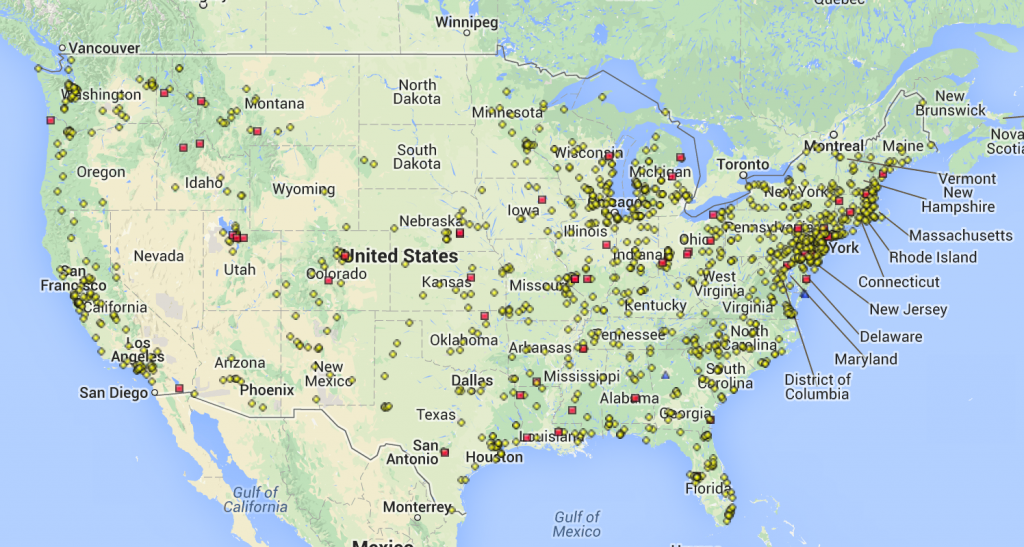
There are roughly 1700 Superfund sites on the National Priority List, which are the sites the EPA considers to be most hazardous and prioritizes for cleanup using Superfund money. National priority sites are selected from tens of thousands hazardous waste sites nationwide; EPA tracks this information in an online database. Here’s a map of proposed and active NPL sites in the continental US:
The Superfund program only addresses a small number of sites where hazardous waste is stored, dumped, or otherwise released into the environment. The Resource Conservation and Recovery Act (RCRA) regulates the disposal of hazardous waste, and the Toxics Release Inventory (TRI) program requires certain types of facilities to report information about emissions and management of toxic chemicals to the EPA.
Taken together, these statutes and programs can give you a pretty good idea of whether there are hazardous sites or toxic chemicals in use near where you live, work, and play, and where those sites are located. Many mapping and informational tools exist to help you find these sites. Here are just a few:
- Superfund NPL Map from EPA
- TOXMAP: Environmental Health e-Map from NIH
- NPL Superfund Footprint from Columbia University
- Cleanups in My Community from EPA
- My Right-to-Know TRI Mapper from EPA (scroll to bottom of page)
- Scorecard, an independent clearinghouse for information on toxic pollution
- My Environment Maps from EPA
Let’s explore what’s in your neighborhood. We’re going to use the My Environment mapping tool because it pulls together information from multiple databases.
- Go to the website, and enter information for the location in which you’re interested. In our case, we’ll do our hometown of Durham, North Carolina.
- Then click on “My Maps” on the left-hand side of the page. This will bring up a map of the location you’ve entered in Step 1.
- In the upper right-hand corner, you can select the data in which you’re interested. We’re going to choose:
- Air > Toxic Releases to Air (TRI)
- Water > Toxic Releases to Water (TRI)
- Land > Superfund Sites (CERCLIS); Hazardous Waste (RCRAInfo); Toxic Releases to Land (TRI); Brownfield Properties (ACRES)
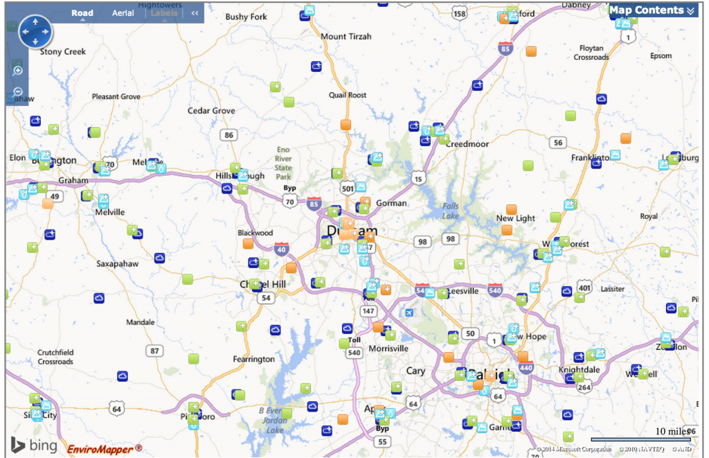
That’s it! Our map now looks like this:
From this picture, we can see that there are dozens of facilities near Raleigh-Durham that are regulated by the EPA. According to this map, there are:
- 153 sites reporting toxic releases to air
- 44 sites reporting toxic releases to water
- 25 Superfund sites (using the Superfund NPL Map, we determined there are 5 NPL sites within 30 miles of Durham)
- 1909 facilities managing hazardous waste under RCRA
- 119 sites reporting toxic releases to land
- 71 brownfields properties
If you hover the mouse over the icons, the map will display links to more information about each of the facilities reporting to the EPA. (Tip: if you zoom in or out, be sure to click “update contents on page” to prompt the map to refresh.) For example, we wanted to learn more about the Ward Transformer Superfund Site, located near the Raleigh-Durham Airport. We clicked on the link, which then advised us we could find out more about Ward Transformer through its page on the EPA’s Superfund website. We were able to learn more about the current site status, cleanup plan, and that PCBs are the major contaminant of concern.
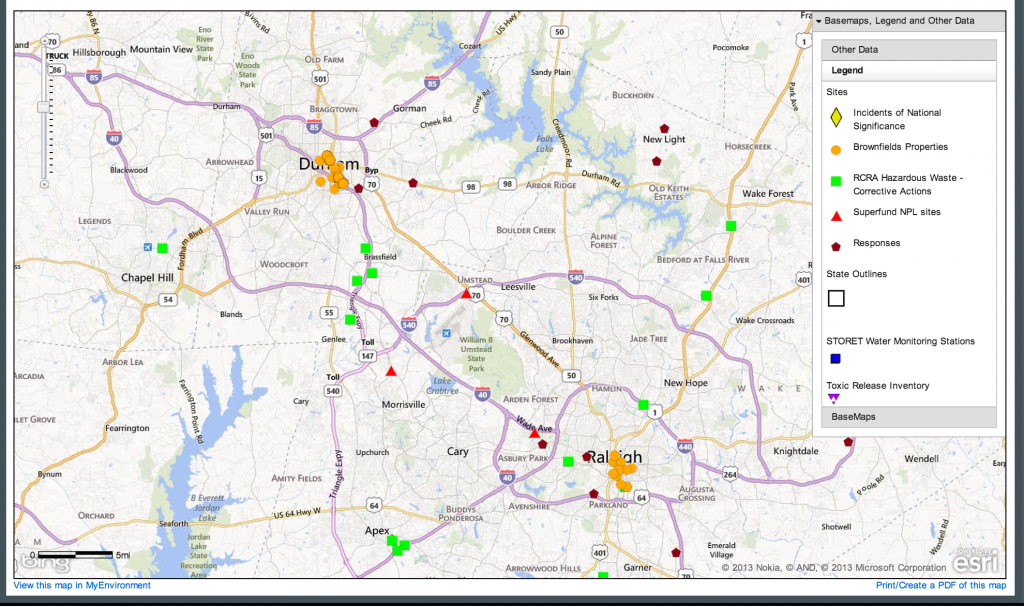
It’s not all bad news out there, though. We wanted to learn more about cleanups that are happening in the Raleigh-Durham area, so we created this map using Cleanups in My Community:
This map tells us that action is being taken to remediate or improve hazardous waste management at numerous locations nearby, including at the Ward Transformer site. Over time, these sites will become less toxic to human and environmental health.
We encourage you to try out these tools and see what you can find out about your community! We bet you’ll learn a lot about what’s happening near where you live, and hopefully gain insight into why remediation is such an important topic. In the coming weeks, we’ll be writing more about remediation, including the remediation efforts at Atlantic Wood Industries Superfund site on the Elizabeth River, where Project 3 studies the effects of PAHs on Atlantic killifish.


